




Historian's route
1 tickets€29
Source: Prof. Dr. İlber Ortaylı (1947–2026)
İlber Ortaylı's Istanbul walk, in two days
1 ticketed stopsOpen the route
A road that starts at Kastabala and Olba in Cilicia and follows Anamur, the Pamphylian plain, the mountain city of Selge, the passes of Termessos, the Klimax shore where Alexander marched through the sea, and Arykanda and Oinoanda in the high valleys of Lycia. We compiled it from the journey Freya Stark made in 1956 by lorry and on horseback, tracing Alexander's march in reverse, and described in her book Alexander's Path; we added the timings, breaks and practical notes.
This route was compiled by AnatoliaPass editors from the published recommendations of the person named; the timings, breaks and practical notes are ours. It does not mean that the person recommends or endorses AnatoliaPass.
Freya Stark (1893–1993) returned to Türkiye several times in the 1950s and wrote a book after each return. In 1952, while sailing along the coasts of Caria and Lycia, she was reading about Alexander's first campaign; after The Lycian Shore, which came out of that voyage, she decided to follow the trail of Alexander's march through Anatolia, this time over land.
Alexander's Path describes Stark's 1956 journey. She follows Alexander's route in reverse: she starts in Cilicia and moves on to Pamphylia, and from there to the high valleys of Lycia. Into the roadless mountain country she goes by lorry, jeep and mule, often alone and on horseback. At the end of the book she adds an appendix with maps showing Alexander's march from Miletus to Phrygia.
Stark's aim was to see on the spot the passes and shores Alexander crossed, and to test Arrian's account on the ground: the place on the Klimax shore where the sea drew back, the narrow pass in front of Termessos, the mountain road to Selge. The hospitality of the villagers she met along the way and Alexander's dream of a united world are the book's other two threads.
We followed the order of the book's chapters: Issus and Kastabala; Mersin, Soli and Olba; Cilician byways; the Pamphylian plain; Mount Klimax; the Pamphylian passes; Selge; the Gelidonya crossing; the Alagir valley; the uplands of Xanthos and Oinoanda. We adapted the routes Stark covered on horseback and on foot to today's roads, and arranged the comings and goings in Pamphylia in a single direction. The timings, driving times and warnings are ours.
Start: Osmaniye; ≈ 20 min along the Kadirli road · stay 90 min
The book's first chapter is Issus and Kastabala: Stark begins her journey on the plain of Issus, where Alexander defeated Darius, between today's Dörtyol and Erzin, and goes up to Kastabala in inland Cilicia. A medieval castle on top of a rock rising from the middle of the plain, and at its foot a colonnaded street and the remains of a theatre and a church: a quiet site.

There is little shade and few facilities at the site; bring water. Check entry arrangements before you go.
≈ 4 hours from Kastabala via Adana and Mersin to Silifke, then up into the mountains · stay 90 min
The book's second chapter is Mersin, Soli and Olba. In the mountains north of Silifke, at Diocaesarea, the holy city of the lands of Olba ruled by priest-kings, the columns of the temple of Zeus Olbios still stand; the temple of Tyche, a monumental gate and a multi-storey tower are also within the city.

The mountain road is winding. Check the site's opening hours before you go.
≈ 2.5 hours from Silifke to Anamur along the coast road · stay 120 min
Stark gives the book two chapters on Cilician byways: from Seleucia, that is Silifke, to Anamur, and from Anamur to Antalya. At Cape Anamur, the southernmost tip of Anatolia, the Roman and Byzantine city of Anemurium runs down the slope to the sea; with its domed tomb houses, baths and odeon, it is one of the best-preserved cities of the dead in Cilicia.

The site is large and has no shade in the midday heat. Check opening hours before you go.
≈ 4 hours from Anamur to Antalya via Alanya; the next morning on to Aksu · stay 120 min
The second part of the book opens with the Pamphylian plain. After Phaselis, Alexander came to Perge, and the city did not resist him; Stark tours the plain in the tracks of his army. The round towers of the Hellenistic gate, the colonnaded street and the water channel running down its middle are still the most impressive sights in Perge today.
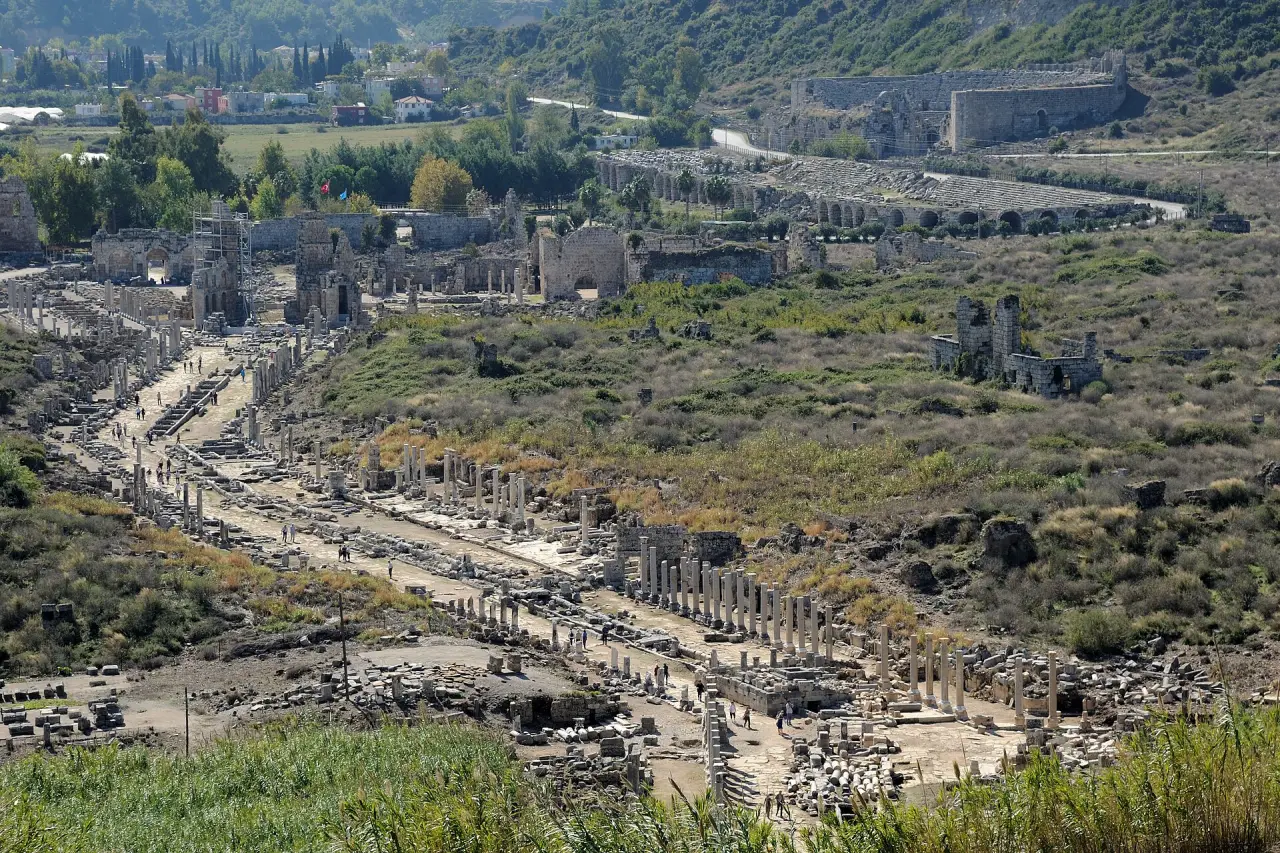
The site has no shade; in summer go early in the morning. Check opening hours before you go.
≈ 1.5 hours from Perge to Altınkaya village by the Köprülü Canyon road · stay 90 min
After Pamphylia, Stark climbs into the mountains, to Selge in the heart of the Taurus, and devotes a chapter of the book to it. According to Arrian, the Selgians were enemies of Termessos; they sent envoys to Alexander and won his friendship. The city's theatre is now intertwined with the houses of Altınkaya village; on the way you cross the Roman bridge in the Köprülü Canyon.
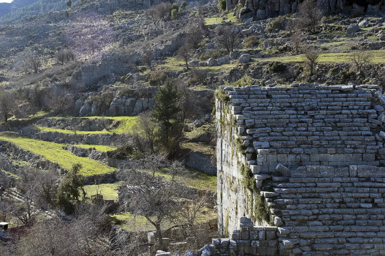
The canyon road is narrow and winding, and gets crowded in the rafting season. Check road conditions before you go.
≈ 2.5 hours from Selge via Antalya to the Korkuteli road · stay 150 min
The mountain roads Stark calls the Pamphylian passes run past Termessos. According to Arrian, Alexander forced the narrow pass in front of the city, but rather than risk a siege of Termessos on its mountaintop he marched on to Sagalassos. Look out from the theatre on the cliff edge and you will see the reason for that decision.
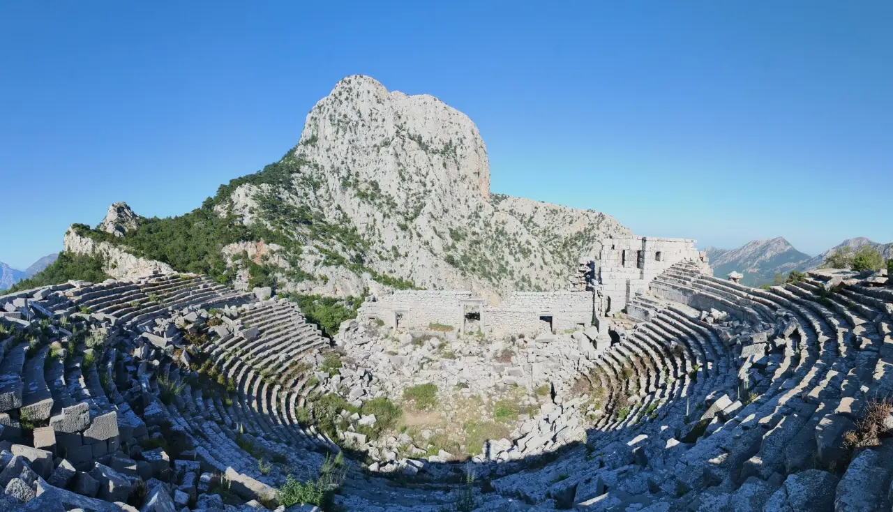
The path is rocky and steep; wear sturdy shoes and bring water. Check the national park's opening hours before you go.
≈ 1.5 hours from Termessos via Antalya and Kemer · stay 120 min
Stark's Mount Klimax chapter tells of Alexander's march from Phaselis to Pamphylia. According to Arrian, the shore where the Beydağları mountains drop steeply into the sea could only be passed when a north wind pushed the water back, and on the day Alexander crossed, the wind blew just as he wished. Phaselis is the three-harboured city where Alexander spent part of the winter.
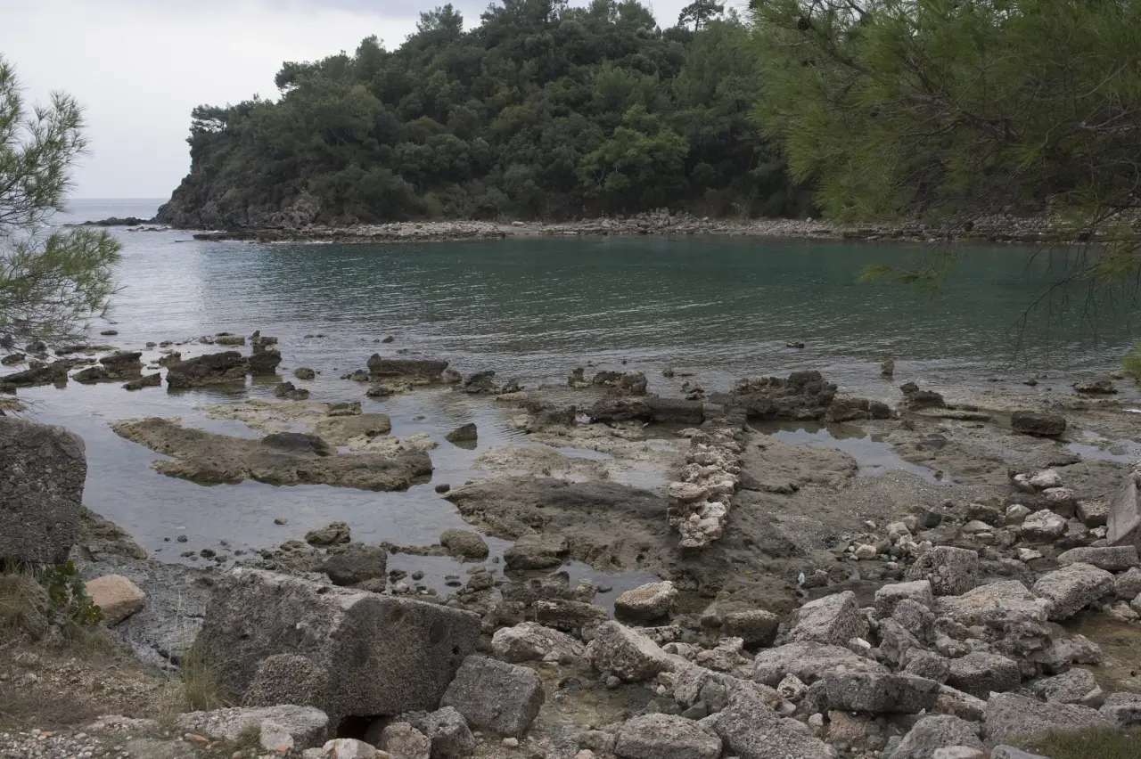
On summer days it gets crowded with boat tours. Check opening hours before you go.
≈ 2 hours from Phaselis via Kumluca and Finike to the Elmalı road · stay 120 min
The book's Lycian section begins with the rounding of Cape Gelidonya and climbs the valley Stark calls the Alagir Chay. On the slope of this valley, which rises from Finike to the Elmalı plateau, lies Arykanda, built on terraces linked by stairways: its baths, agora, theatre and stadium are set into the mountain step by step.
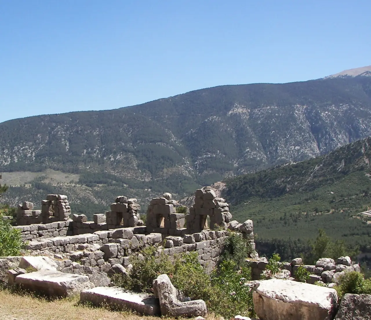
The walk between the terraces is steep and rocky. Check opening hours before you go.
≈ 2.5 hours from Arykanda via Elmalı to Seki and the village of İncealiler; ≈ 45 min walk from the village · stay 120 min
The book ends with Oinoanda and the passes of Xanthos. The city, built on a ridge at nearly 1,400 metres in the upper valley of the Xanthos river, is known for the giant philosophical inscription that the Epicurean philosopher Diogenes had carved on a wall for his fellow citizens; fragments of it are still being found and read at the site. The last stop on Stark's long journeys on horseback.

The path up to the site is long and partly unmarked; take water and a local guide with you. Check transport and visiting arrangements before you go.
≈ 2 h 15 min · fast ferry + bus · Day trip
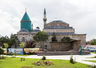
Why here: The first Ottoman capital. The Green Mosque, the Grand Mosque and Koza Han make an easy day trip; we suggest it if you are staying in Istanbul for more than four days. Not part of this route.
Travellers who check in on this route can rate it. No one else can.
Be one of the first travellers to walk this route. If you have a question or a tip, share it with the community.
After walking the route you can rate it using the check-in in the app. Reviews go live after a short check.
Source: Prof. Dr. İlber Ortaylı (1947–2026)
Source: Prof. Dr. İlber Ortaylı (1947–2026)
Your basket stays saved on this device, so you can pick up where you left off once sales open. Until then, routes, the map and audio guides are free.