




Historian's route
1 tickets€29
Source: Prof. Dr. İlber Ortaylı (1947–2026)
İlber Ortaylı's Istanbul walk, in two days
1 ticketed stopsOpen the route
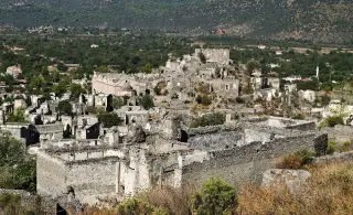
A half-day walk through a village emptied when its Greek population left in the 1923 population exchange and largely destroyed by the 1957 earthquake: the lower church, then the red-dot path to the hilltop chapel and the upper church above the village. Hundreds of stone houses lining the slope are the quietest witnesses to the exchange.
Dark tourism means visiting places where people have confronted suffering, loss and hard labour: prisons, dungeons, abandoned and submerged towns, underground shelters, and the factories and mines that paid the price of industry. Every place in this collection can be visited legally and with permission; there are no routes into abandoned private property or building sites, or routes built around watching neighbourhoods where people live. Battlefields, martyrs' cemeteries and memorial sites are in the “Remembrance and mourning” collection. Please respect the story of the places you visit.
Start: village entrance; ≈ 20 min by dolmuş or taxi from central Fethiye · stay 30 min
One of the village's two large churches, in its lower part; 17th century according to the sign on site. With its stone façade and arched entrance, it is one of the best-preserved buildings in the village.
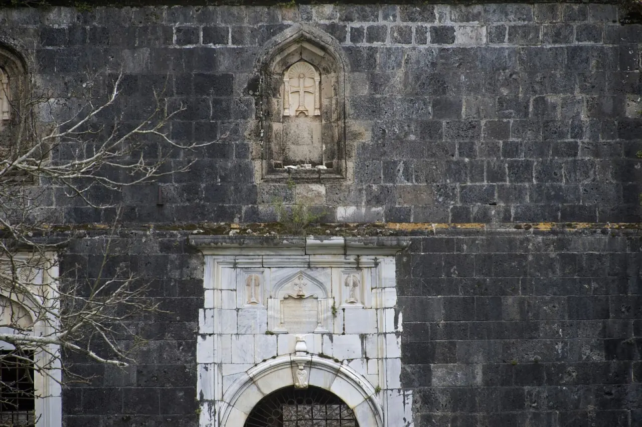
The church is usually closed; you can see it from outside and from the courtyard. Check tickets and hours before you go.
≈ 20 min climb from the lower church on the path marked with red dots · stay 30 min
A small chapel on the hill south-west of the village; from here you can see the whole slope, the rows of houses and the valley. This is the best place to grasp how big the village was.
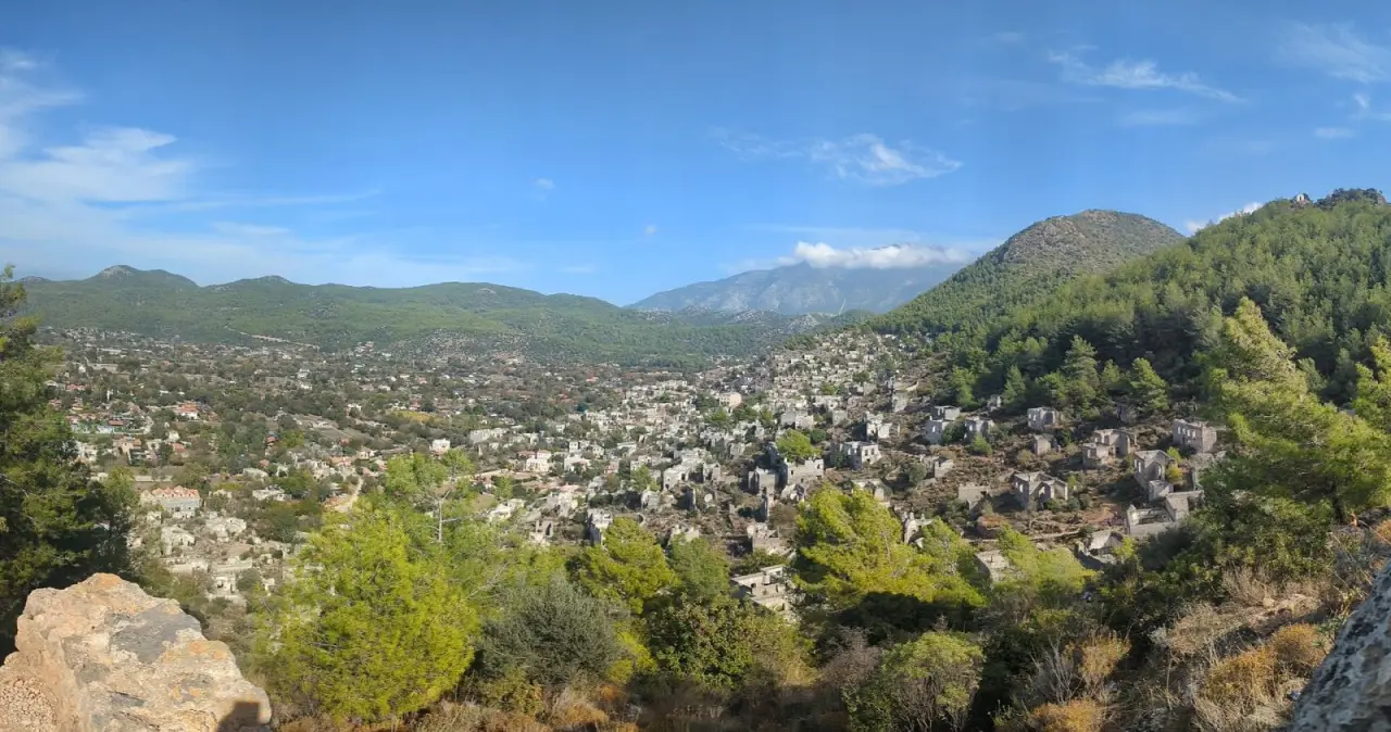
The path is steep and stony; take care on the way down. Location: OSM.
≈ 30 min from the chapel along the slope between the houses (if you can't find the path, go back to the lower church and climb ≈ 10 min from there) · stay 40 min
The large church in the upper part of the village; together with the houses around it, one of the highest points of the village. Looking down from here, you sense the silence of the emptied village more strongly. If you like, you can continue from here on the path down to Ölüdeniz.
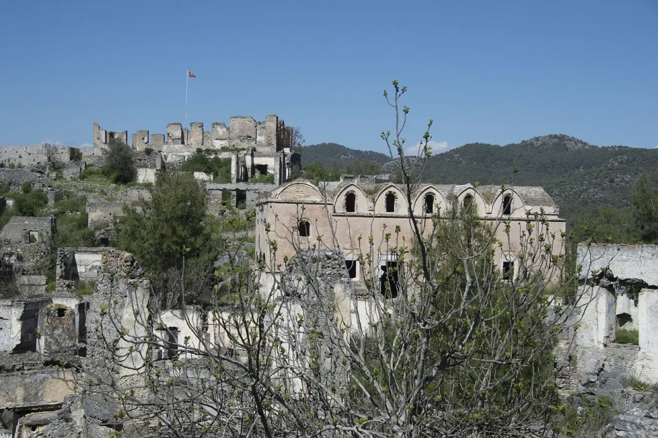
For the length and condition of the Ölüdeniz path, check an up-to-date hiking map; if you are walking alone, let someone know.
≈ 2 h 15 min · fast ferry + bus · Day trip
Why here: The first Ottoman capital. The Green Mosque, the Grand Mosque and Koza Han make an easy day trip; we suggest it if you are staying in Istanbul for more than four days. Not part of this route.
Travellers who check in on this route can rate it. No one else can.
Be one of the first travellers to walk this route. If you have a question or a tip, share it with the community.
After walking the route you can rate it using the check-in in the app. Reviews go live after a short check.
Source: Prof. Dr. İlber Ortaylı (1947–2026)
Source: Prof. Dr. İlber Ortaylı (1947–2026)
